Old Maps
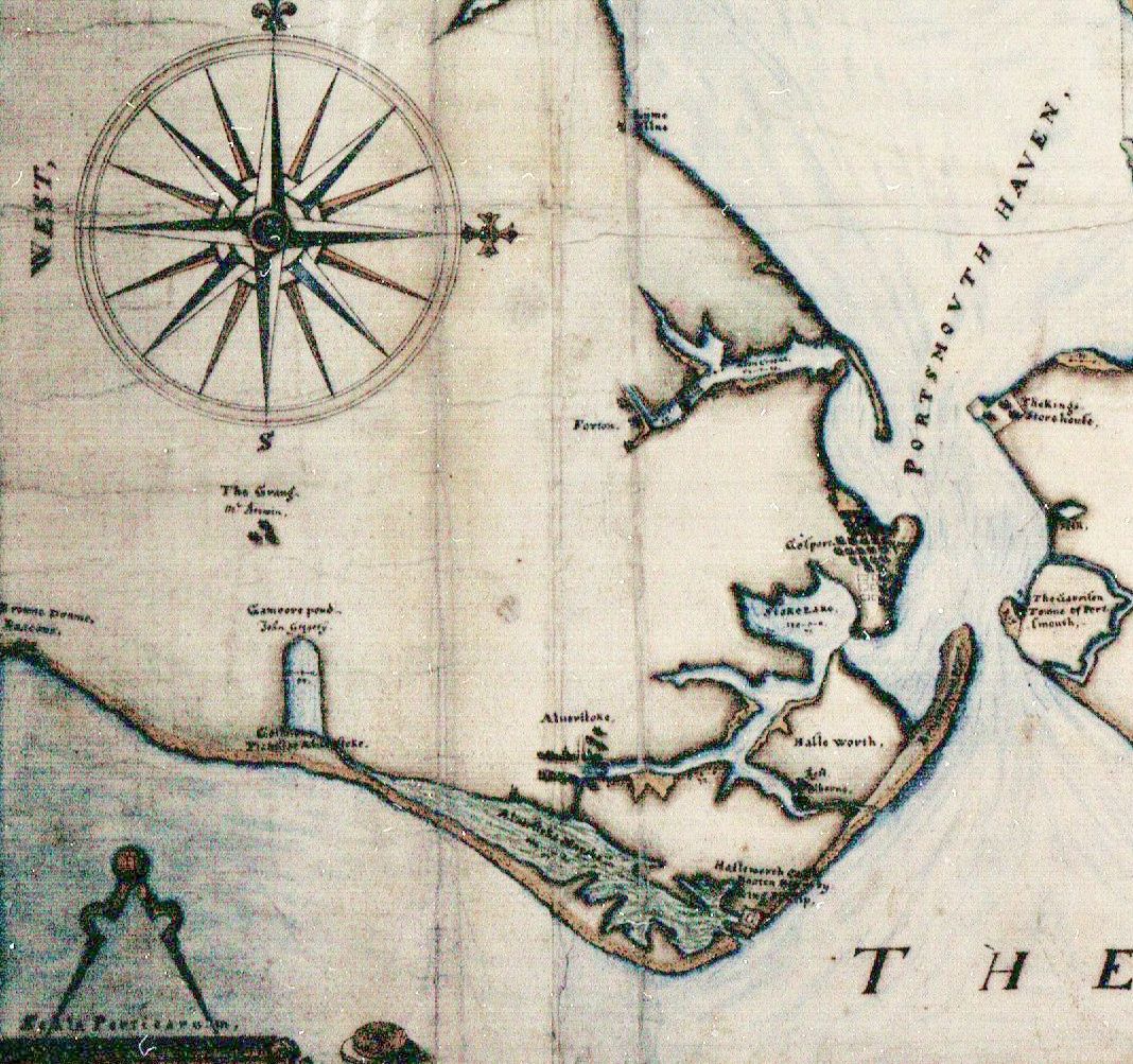
1625 Map
The village is marked at the head of the creek. Marshes extend the length of Stokes Bay and link with the River Alver. Hasleworth Castle is marked close to the point where the River Alver joins the sea
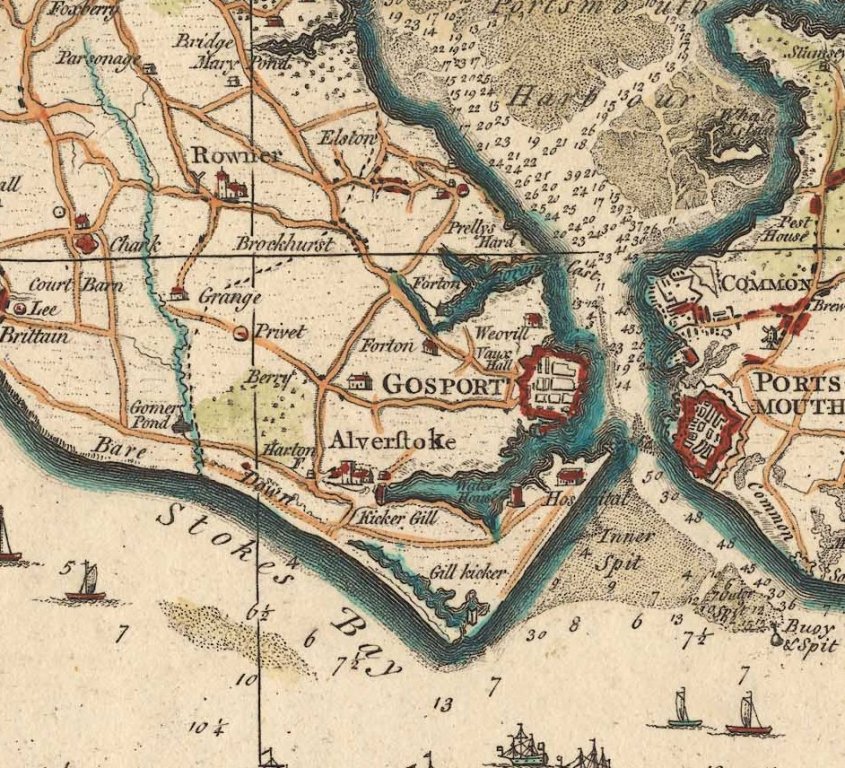
1759 Map
Kickergill and Gilkicker appear with Haslar Hospital. Hasleworth Castle has disappeared
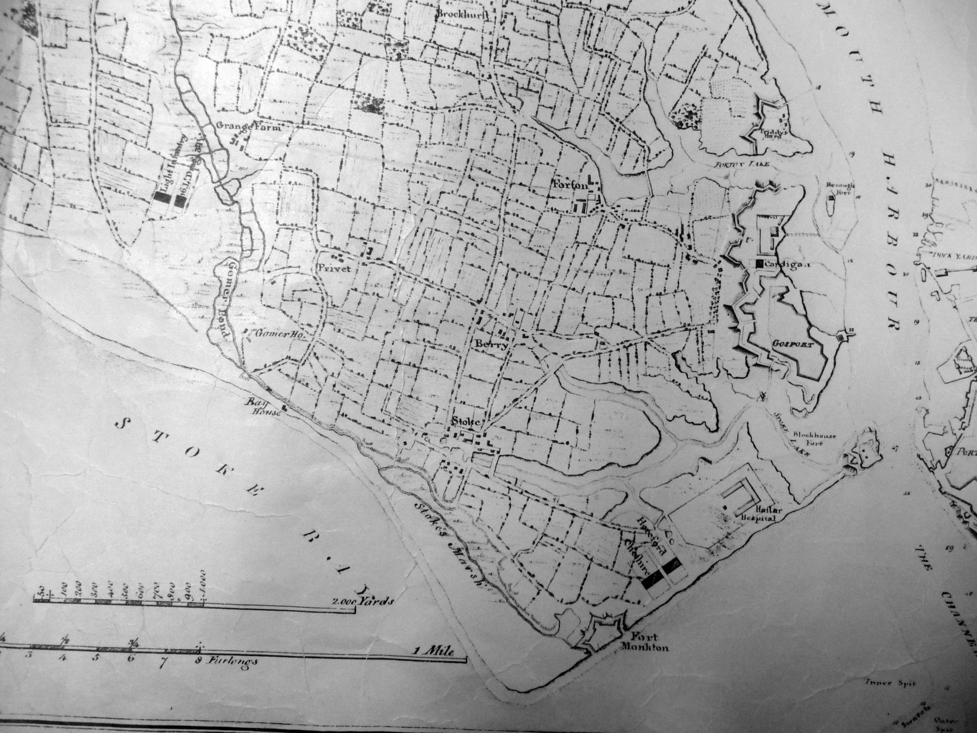
1782
Fort Monckton and the Barracks appear
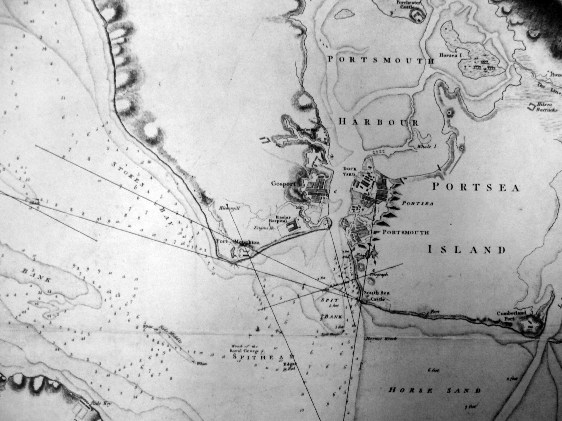
1783
Interesting chart showing the transits on Gilkicker, Kickergill and Southsea Castle to guide shipping
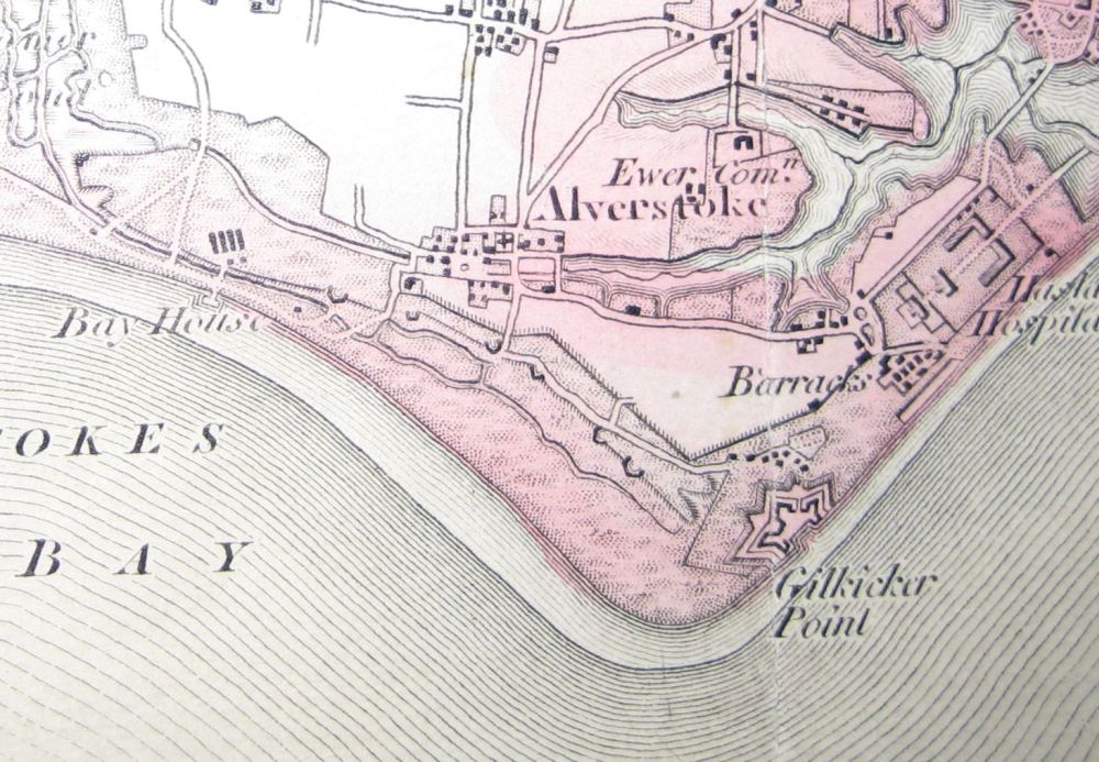
1810
We now see Bay House and a growing village
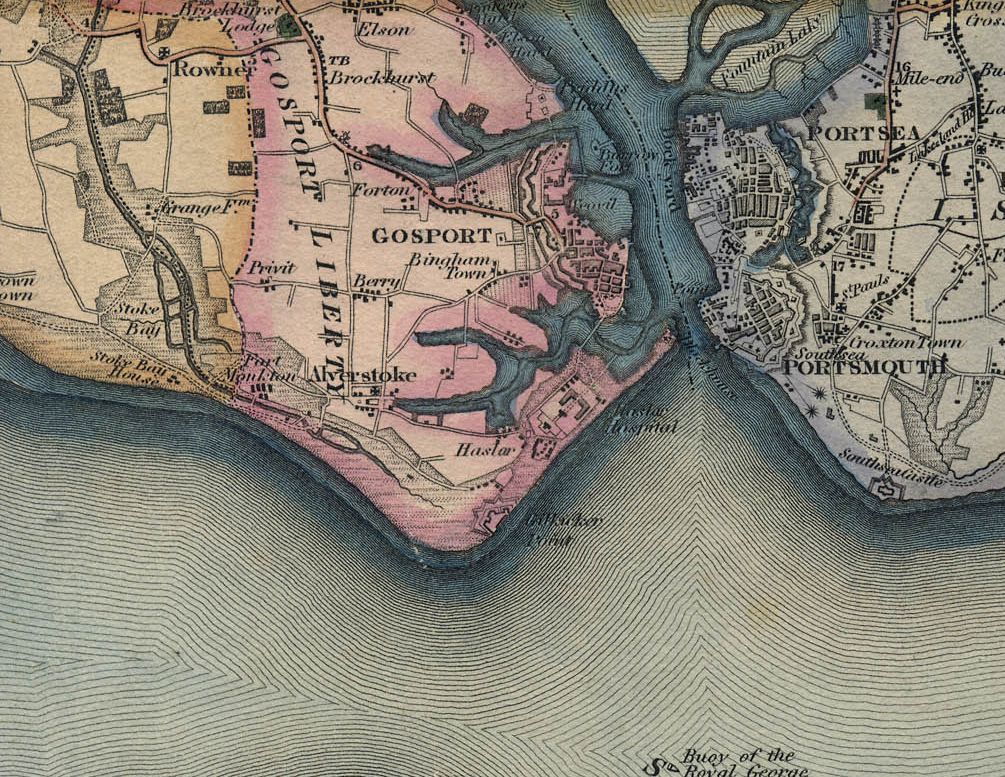
1826
The River Alver is shown linking to the Gilkicker marshes
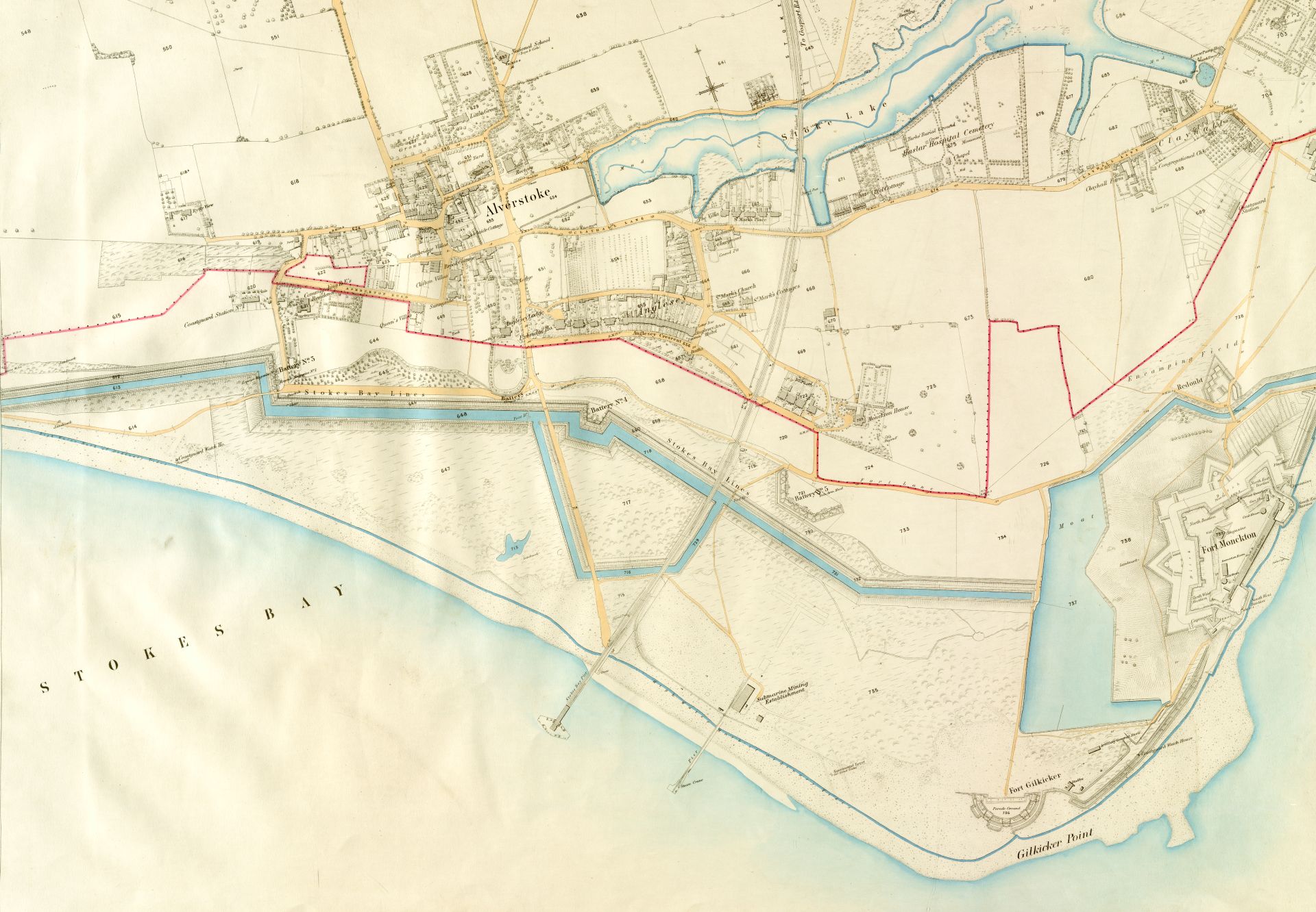
1862 and 1890
The Stokes Bay Lines together with the railway line, Stokes Bay pier, Anglesea Crescent and St Mark's Church have now appeared
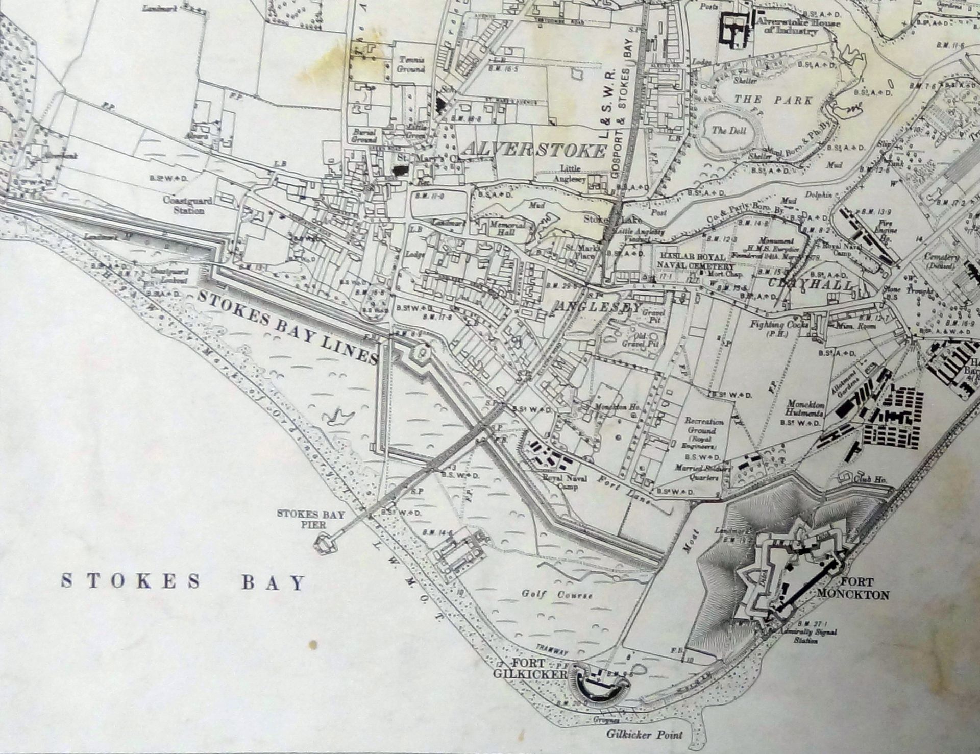
1922
Haslar Naval Cemetery has appeared together with the gravel pits at the bottom of my garden in Monckton Road (now a housing estate)
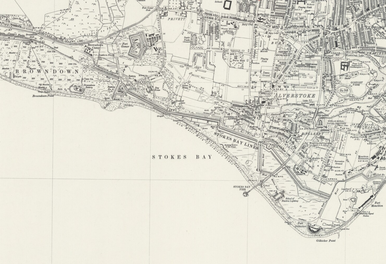
1946
The School of Electric Lighting and other remnants of the use of the bay during the lead up to D-Day are all marked